  |

Click 'Arrow' Above To Go To Next South Bound Stop |
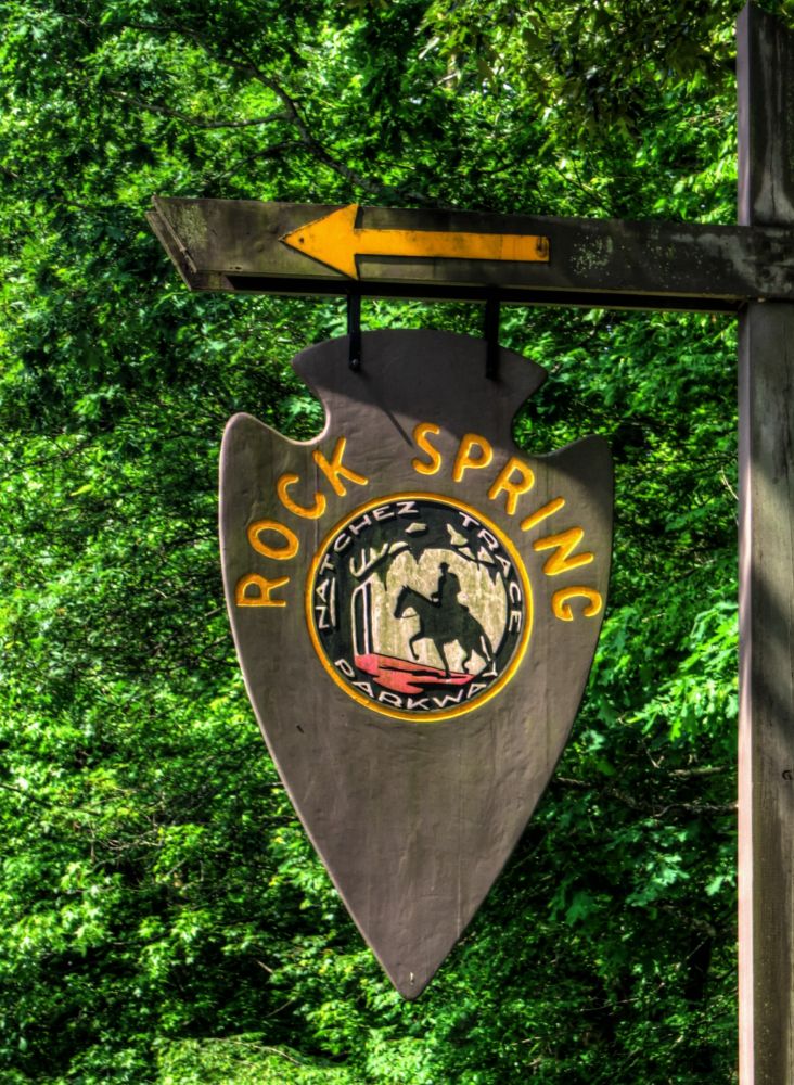
Rock Spring
Mile Post 330.2 |

Click 'Arrow' Above To Go To Next North Bound Stop |
|
Rock Spring
Located At This Stop Self Guided Trail Distance to Nearest Parkway Restroom 34.3 Miles North to Glenrock Branch 2.9 Miles South to Colbert Ferry Distance to Nearest Gas Stations 6.3 Miles North to AL Hwy 20 Then 2.9 Miles East 9.9 Miles South to US 72 Then 0.5 Miles East |
|
|
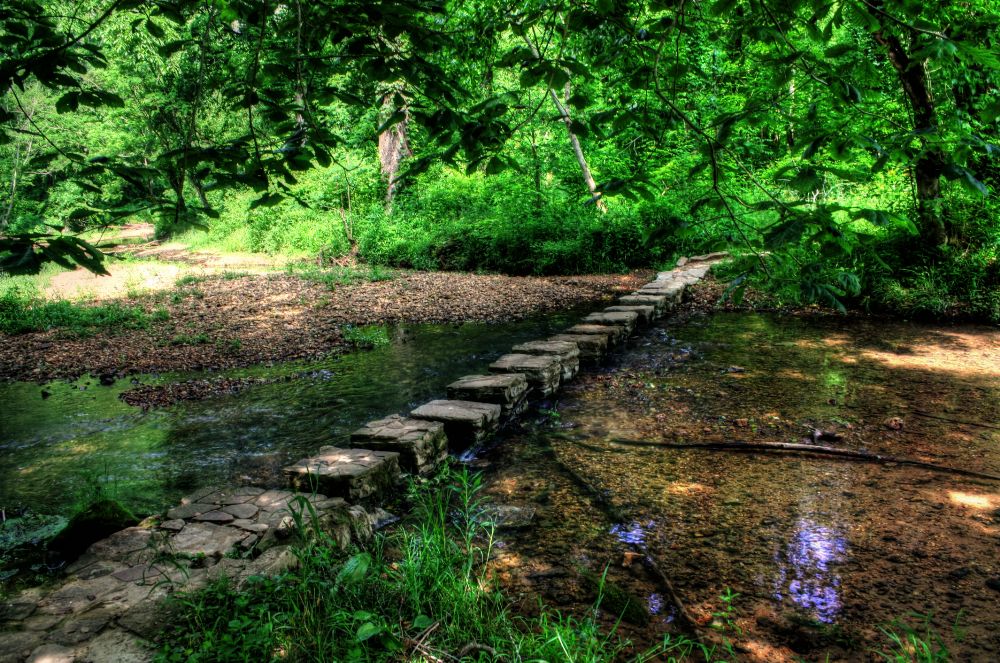
Rock Spring Rock Spring Nature Trail offers you an opportunity to explore a small natural spring as it bubbles forth from the ground. Small fish dart about a deep pool created as the stream wandered through rich bottomland soil and limestone rock. Vegetation and trees change as you move through as abandoned field past the stream onto a rocky hillside. After completeing the 20 minute walk, you may decide to pull off your shoes and dangle you feet in the swift cool waters. (National Park Service) |
|
|
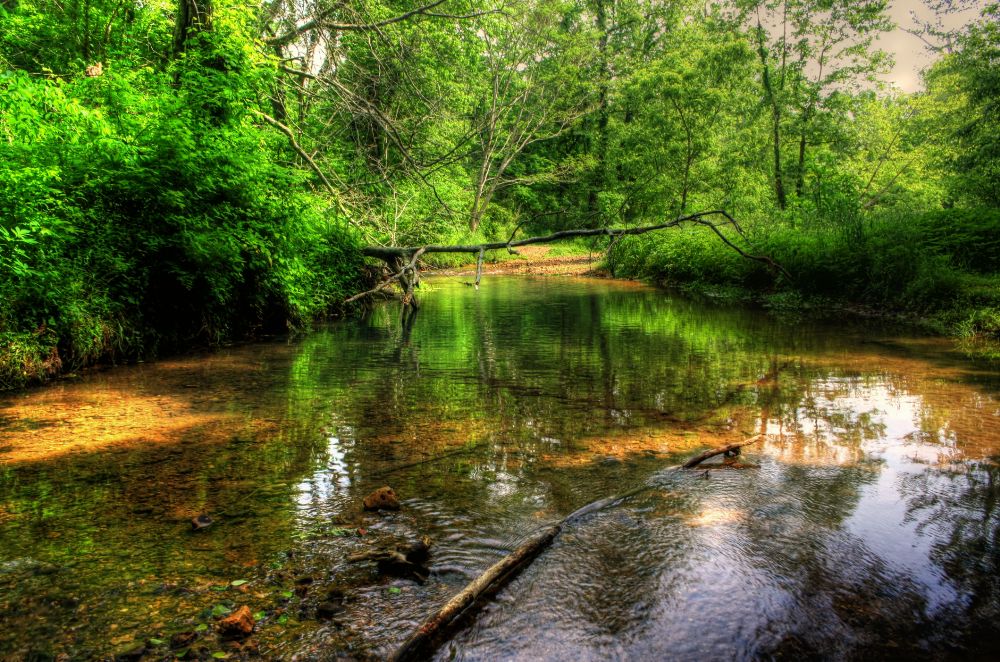
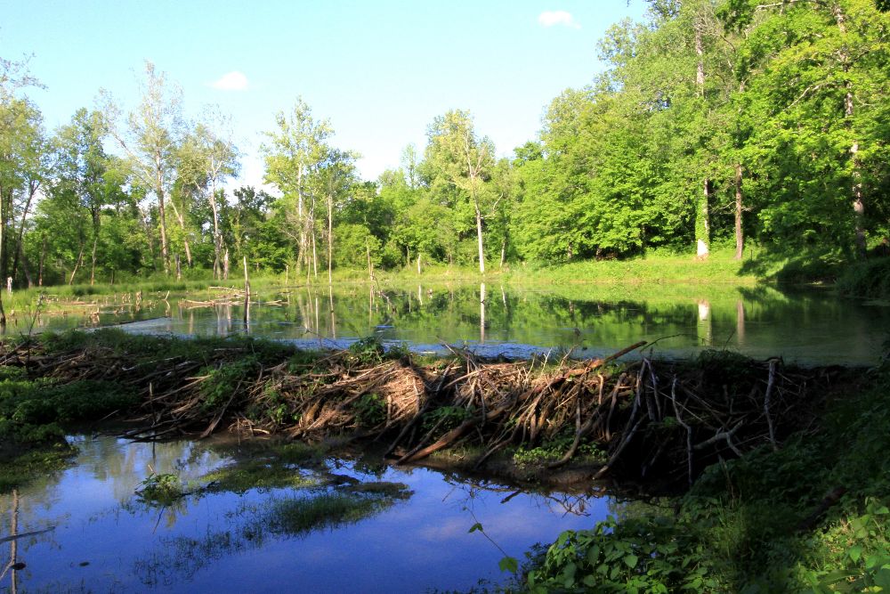
Colbert Creek |
|
|
Rock Spring Beaver Dam The trails and stepping stones in this area lead you across Colbert Creek past Rock Spring, and through the woodlands. Since 1977, numerous beaver dams have been built then abandoned or destroyed by high water. Walk the trails and enjoy the changing evnironment of the one free-flowing stream. (National Park Service) |
|
Click 'Arrow' Above To Go To Next South Bound Stop |
Rock Spring
Mile Post 330.2 |
Click 'Arrow' Above To Go To Next North Bound Stop |

|
|
Copyright © 2023-2026 Larry G Banks All Rights Reserved |